بحث عن مدائن صالج جاهز باللغة الانجليزية

Mada’in Saleh
Mada’in Saleh (Arabic: مدائن صالح, madāʼin Ṣāliḥ, “Cities of Saleh”), also called “Al-Hijr” or “Hegra”, is an archaeological site located in the Sector of Al-`Ula within Al Madinah Region, the Hejaz, Saudi Arabia. A majority of the remains date from the Nabatean kingdom (1st century AD). The site constitutes the kingdom’s southernmost and largest settlement after Petra, its capital.[1] Traces of Lihyanite and Roman occupation before and after the Nabatean rule, respectively, can also be found.
The Qur’an[2][3][4][5][6][7][8] places settlement of the area by the Thamudi people during the days of Saleh, between those of Nuh (Noah) and Hud on one hand, and those of Ibrahim (Abraham) and Musa (Moses) on the other. According to the Islamic text, the Thamudis were punished by Allah for their practice of idol worship, being struck by an earthquake and lightning blasts. Thus, the site has earned a reputation as a cursed place — an image which the national government is attempting to overcome as it seeks to develop Mada’in Saleh for its potential for tourism.
In 2008 UNESCO proclaimed Madaʼin Saleh as a site of patrimony, becoming Saudi Arabia’s first World Heritage Site. It was chosen for its well-preserved remains from late antiquity, especially the 131 rock-cut monumental tombs, with their elaborately ornamented façades, of the Nabatean kingdom.
Name
Its long history and the multitude of cultures occupying the site have produced several names. References by Strabo and other Mediterranean writers use the name Hegra for the Nabatean site.[9] The current name refers to the Islamic Nabi (Arabic: نَـبِي, Prophet) Salih. The name Al-Hijr (Arabic: الحجر, “The Stoneland” or “The Rocky Place”),[4] has also been used to allude to its topography.[10]
Location
The archaeological site of Mada’in Saleh is situated 20 km (12.4 mi) north of the town of Al-`Ula, 400 km (248.5 mi) north-west of Medina, and 500 km (310.7 mi) south-east of Petra, Jordan. The site is on a plain, at the foot of a basalt plateau, which forms a portion of the Hijaz mountains. The western and north-western portions of the site contain a water table that can be reached at a depth of 20 m (65.6 ft).[10] The setting is notable for its desert landscape, marked by sandstone outcrops of various sizes and heights.[11]
History
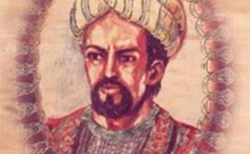
According to Islamic tradition, by the 3rd millennium BC, the site of Al-Hijr had already been settled by the tribe of Thamud,[12] who carved the structures into rock.[2][3][4][5][6][7][8] The tribe fell to idol worship, and oppression became prevalent.[13] Salih,[2][3][5][6][7][8] to whom the site’s name of “Madaʼin Salih” is often attributed,[14] called the Thamudis to repent.[13] The Thamudis disregarded the warning and instead commanded Saleh to summon a pregnant she-camel from the back of a mountain. And so, a pregnant she-camel was sent to the people from the back of the mountain by Allah, as proof of Saleh’s divine mission.[13][15] However, only a minority heeded his words. The non-believers killed the sacred camel instead of caring for it as they were told, and its calf ran back to the mountain where it had come from, screaming. The Thamudis were given three days before their punishment was to take place, since they disbelieved and did not heed the warning. Saleh and his Monotheistic followers left the city, but the others were punished by Allah —their souls leaving their lifeless bodies in the midst of an earthquake and lightning blasts.[11][13]
Lihyan era
Archaeological traces of cave art on the sandstones and epigraphic inscriptions, considered by experts to be Lihyanite script, on top of the Athleb Mountain,[12] near Mada’in Saleh, have been dated to the 3rd–2nd century BC,[10] indicating the early human settlement of the area, which has an accessible source of freshwater and fertile soil.[12][14] The settlement of the Lihyans became a center of commerce, with goods from the east, north and south converging in the locality.
Nabatean era
Myrrh was one of the luxury items that had to pass through the Nabatean territory to be traded elsewhere.
The extensive settlement of the site took place during the 1st century AD,[16] when it came under the rule of the Nabatean king Aretas IV Philopatris (Al-Harith IV) (9 BC –40 AD), who made Mada’in Saleh the kingdom’s second capital, after Petra in the north.[12] The place enjoyed a huge urbanization movement, turning it into a city.[12] Characteristic of Nabatean rock-cut architecture, the geology of Mada’in Saleh provided the perfect medium for the carving of monumental and settlements, with Nabatean scripts inscribed on their façades.[10] The Nabateans also developed oasis agriculture[10]—digging wells and rainwater tanks in the rock and carving places of worship in the sandstone outcrops.[14] Similar structures were featured in other Nabatean settlements, ranging from southern Syria (region) to the north, going south to the Negev, and down to the immediate area of the Hejaz.[10] The most prominent and the largest of these is Petra.[10]
At the crossroad of commerce, the Nabatean kingdom flourished, holding a monopoly for the trade of incense, myrrh and spices.[11][17] Situated on the overland caravan route and connected to the Red Sea port of Egra Kome,[10] Mada’in Saleh, then referred to as Hegra among the Nabateans, reached its peak as the major staging post on the main north–south trade route.
Roman era
In 106 AD, the Nabatean kingdom was annexed by the contemporary Roman Empire.[17][18] The Hejaz, which encompasses Hegra, became part of the Roman province of Arabia.[10]
The Hedjaz region was integrated into the Roman province of Arabia in 106 AD. A monumental Roman epigraph of 175-177 AD was recently discovered at al-Hijr (then called “Hegra” and now Mada’in Saleh).
The trading itinerary shifted from the overland north–south axis on the Arabian Peninsula to the maritime route through the Red Sea.[14] Thus, Hegra as a center of trade began to decline, leading to its abandonment.[18] Supported by the lack of later developments based on archaeological studies, experts have hypothesized that the site had lost all of its urban functions beginning in the late Antiquity (mainly due to the process of desertification).[10] Recently evidence has been discovered that the Roman legions of Trajan occupied Mada’in Salih in northeastern Arabia, increasing the extension of the “Arabia Petraea” province of the Romans in Arabia.
The history of Hegra, from the decline of the Roman Empire until the emergence of Islam in the days of Muhammad, remains unknown.[18] It was only sporadically mentioned by travelers and pilgrims making their way to Mecca in the succeeding centuries.[14] Hegra served as a station along the Hajj route, providing supplies and water for pilgrims.[18] Among the accounts is a description made by 14th-century traveler Ibn Battuta, noting the red stone-cut tombs of Hegra, by then known as “al-Hijr.”[10] However, he made no mention of human activities there.
.
.
__________________________________
اضغط الرابط أدناه لتحميل البحث كامل ومنسق جاهز للطباعة